Leave the ground work to us so your organization can focus on identifying and preserving high value habitats and landscapes. Eco Hawk offers conservation easement and preserve monitoring, land management plan development, and community outreach services. If your caught between the challenge of funding staff and a high work demand, Eco Hawk can fill the gap.
Ground Monitoring
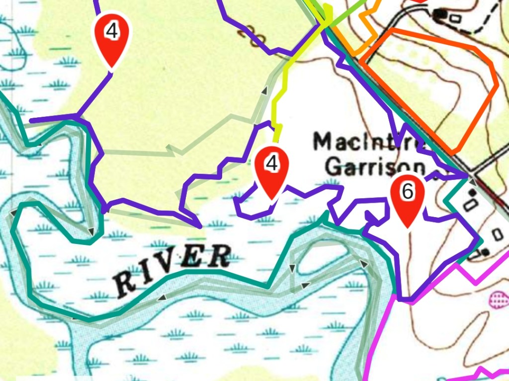
We’re happy to take on any project, no matter the size. We will ground monitor just one property or a portfolio of properties, whatever your organization needs. Standard ground monitoring contracts include careful review of property deeds / executory interests, past monitoring reports and available aerial imagery. During ground monitoring Eco Hawk will create a track of the monitoring visit and record important data when necessary. We generally use Gaia GPS for tracks and Survey 123 for recording data such as boundary markers, encroachments and ecological concerns. Detailed reports of monitoring visits are produced to meet Land Trust Alliance standards. We’re also happy to tailor our visits to your organizational needs and the data platforms you use.
Land Management Plans
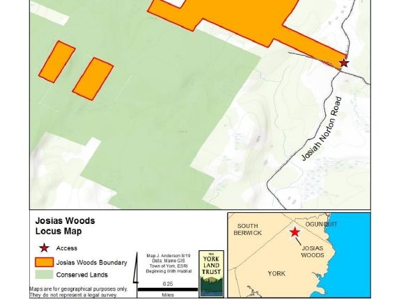
Writing land management plans can be an exciting yet arduous task. A well written plan requires a detailed understanding of your under-writers expectations and your land trust’s goals for the property. Working with your organization, EcoHawk will create a land management plan according to your goals. We’re happy to start where your needs begin. We’ll incorporate the data you provide (such as maps, baseline assessment, acquisition details) along with our own research (such as historical use, archeological sites and soil maps) to create a high quality, durable management plan. If you would like to see a sample of our work, just contact us here. (Please, requests for legitimate business purposes only.)

Traditional and Digital Outreach
Staying connected with your members, volunteers and local community is the lifeblood of every small land trust. Engage your community with a variety of outreach tools such as Story Maps and blog posts and newsletters. EcoHawk owner, Chris Ring, is a frequently published writer of works of fiction and non-fiction. His writing has appeared in literary journals, trade journals, regional magazines and popular blogs. Whether it’s just one idea or a larger project, Chris will be happy to help. For an example of a StoryMap, click here.
Story Maps

By combining GIS maps, video, photography and state of the art web presentation tools, story maps are a compelling format for sharing the science and hiking boot-on-the-ground work of your organization. This interactive outreach tool keeps the learning of science, further boosting participation in the community.
On The Ground Partners
- Land Trusts
- Watershed coucils
- Environmental consultants
- Municipalities
- Non-profits
- Reserves / parks/
- Foresters
