We offer a range of services to help you achieve your conservation goals. We use proven software and workflows for efficient and accurate aerial imagery.
Basic Aerial Survey
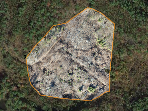
Orthomosaic “maps” provide real time imagery with high spatial resolution, unmatched by satellites and USGS surveys. Access the data you need when you need it.

Aerial Topo Surveys
Analyze your site in three dimension. Topo surveys provide Digital Elevation Models that track the changes in vegetative structure at your site. Good management demands good data.
Aerial Photo Point Monitoring
Track the story of seasonal and restorative change at landscape scale. Efficiently monitor ecosystem change and the impact of natural events.

Aerial Photography and Videography
Sharing your work is an integral part of land management. Motivate supporters with engaging videos and photos.

360° Virtual Tours
Cinematic effects engage stakeholders in ways that still photos can never achieve.

Story Maps
Story Maps engage supporters with the science and mission of your organization. Share the science, keep the fun.
Basic Aerial Survey
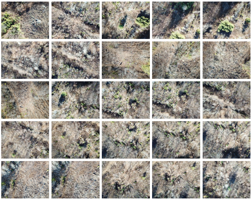
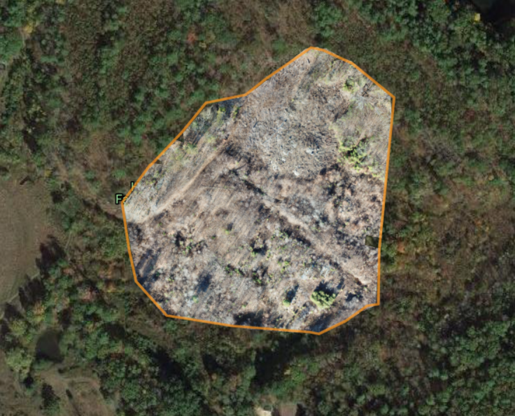
Stay connected with your changing landscape. Aerial surveys use dozens, sometimes even hundreds of photos and “stitch” them together like a patchwork quilt. Each photo is geo-referenced for accuracy and seamlessly connected to adjacent images. For higher level demands, those coordinates are rectified with ground control points for more accurate data. The end product is a real time, high resolution orthomosaic “map” (image) superior to satellite and USGS plane based surveys. Make accurate measurements of change. The flexibility and low cost of drone deployments allows you to capture the data you need, when you need it most. Give your organization a hawk’s eye view of your conservation area.
Aerial surveys are a great tool for:
- Annual conservation easement assessments
- Inaccessible terrain
- Pre-acquisition site surveys
- Tracking changes in restoration areas
- Baseline assessments
- Repetitive and / or seasonal monitoring
- Studies in habitat niches
Aerial Topo Surveys
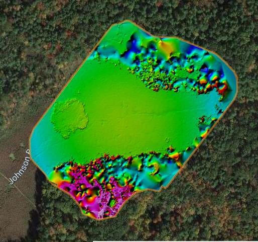
Analyze your site in three dimension. Utilizing the imagery created in a basic aerial survey, topo surveys provide Digital Elevation Models (DEM) that help tell the story of your changing landscape. Understanding the real time conditions of your conservation area is vital to making sound management decisions. From repetitive monitoring programs on restored habitats to natural event assessments, topo surveys offer an elevated perspective. Good management demands good data.
Aerial surveys are a great tool for:
- Repetitive monitoring where niche habitats preservation matters
- Tracking changes in vegetative structure
- Natural event assessment: flooding, major storms, wind events
- Damage from easement encroachment
- Migrating marshes – baseline surveys
Aerial Photo Point Monitoring


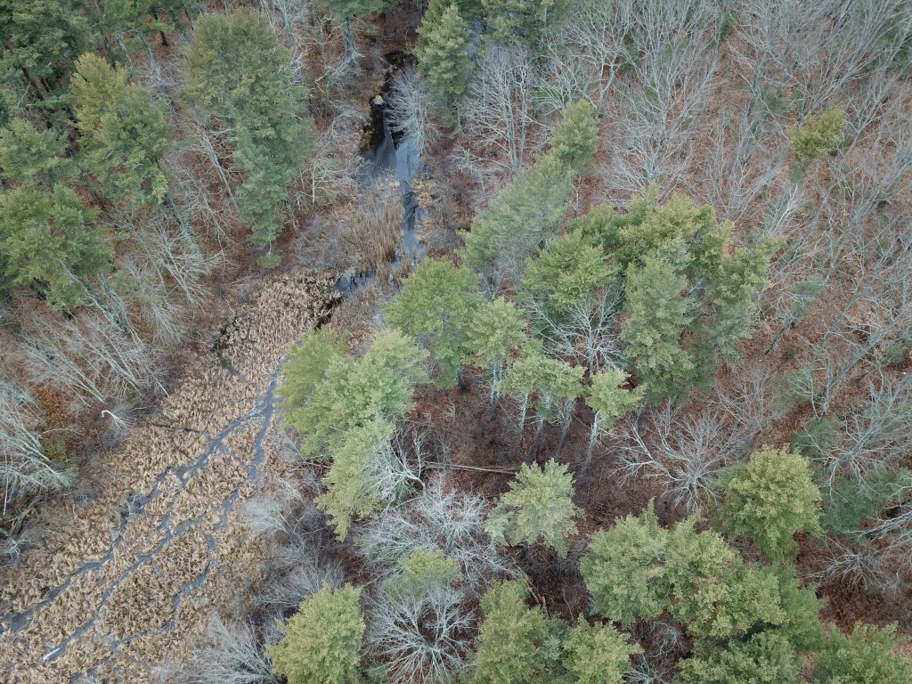
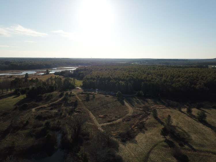
Track the story of seasonal and restorative change at landscape scale. Using repeat aerial photography, photo point monitoring is an easy yet effective method for monitoring ecosystem change. This is the most basic of aerial monitoring options. The imagery produced is raw imagery; still shots and 90° images that offer an up close view of your landscape; unprocessed video flyovers. Make your conservation impact visible.
Aerial surveys are a great tool for:
- Inaccessible sites
- Areas of low encroachment concern
- Preserve and let be sites
- “Unmanaged” properties
- Open and unforested spaces; shorelines
Aerial Photography and Videography
No conservation organization is an island, even if it is just an island preserve. Partners, volunteers and donors are as important as the decisions you make. EcoHawk produces video and photography to support your wider organizational needs.
Video is an absolutely vital tool for involving volunteers, donors and neighbors in the work of land conservation.
Brandon Hayes, Director at Open Lands
360° Virtual Tours
Story Maps

By combining GIS maps, video, photography and state of the art web presentation tools, story maps are a compelling format for sharing the science and hiking boot-on-the-ground work of your organization. This interactive outreach tool keeps the learning of science, further boosting participation in the community.
Benefits of Real Time Imagery
On The Ground Partners
- Leaf off
- Leaf Out
- Peak Green
- High water / Low water
- Post burn / rehab / restoration
- Seasonal events
- Natural “disasters”
- Land Trusts
- Watershed coucils
- Environmental consultants
- Municipalities
- Non-profits
- Reserves / parks/
- Foresters
